Let me tell you about my little adventure in the Swedish arctic.

I first heard of the Kungsleden (kings trail) through National Geographic, and one of the ads they run on adventure websites – It was something like, “These are the five trails you must hike!” I’d never been to Sweden, but had always wanted to go, so I looked into it. This was maybe back around 2013. Well, as my 50th birthday started to creep ever closer I decided to do this hike as a reward for having survived that long on this planet. I embarked on this adventure on September 4th, 2016.
I used a trail guide self-published by Cody Duncan, and it really was helpful. I took a hard copy of the pertinent pages of the Cody Duncan guide with me, and there were a couple ladies on the trail using the same guide. They’d scanned their copy into their phones. Since I can no longer find the book, I’ve borrowed this image from another website – I did the section Abisko to Nikkaluokta:

I wanted the full “I am really far away from it all” experience so after making my way by air to Stockholm I took a 20 hour train ride to Abisko. For those less into this type of experience, there is an airport about a half hour away from Abisko, in Norway. For those who are open to this experience, the train station is directly under Stockholm Arlanda airport. There is an entrance to the train station in the newer section of the airport – And the station is very far underground.
I arrived in Abisko late afternoon on September 6th, so my plan was to camp at the Turistation for the night and set out the next day. The train station is right by the start of the trail. So I snapped the selfie above, and then set off in the wrong direction trying to find the Turistation. Awesome. Abisko Turistation is about 5 minutes, at most, from the train station – But for some reason I wanted to walk about 45 minutes up a hill to what looked like a chalet with ski lift beside it. Good times! The people there politely pointed me back in the right direction.
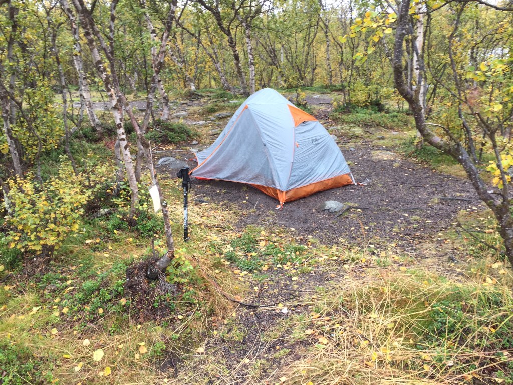
For those unfamiliar, Abisko is apparently one of the best places in Europe to see the northern lights. So naturally there is a nice Turistation there. The setting is beautiful, overlooking a lake, and it has a pretty decent restaurant from what I hear. I pitched my tent in the camping area:
I set off the next morning, with a steady rain. It was a fairly easy trek of 15 km (9.3 miles) to Abiskojaure hut, with mostly flat terrain. Let me tell you about these huts, real quick. They are nice. They are bunk houses, with staff on site during the season. There is a kitchen with liquid propane stoves, drying rooms for you damp clothing, and wood fired saunas at most of them. Also, most of the huts now have water pumped close to them – In days past you would have to fetch water from the nearby river. None of the huts have electricity, or running water. And you will need to be OK with using a privy, though they are not in too bad condition – There is staff on hand at every hut during the season, and they clean things. The huts are not free, though. And it will serve you well to buy a membership, which will pay for itself in just 5 nights.
Let me also add that I was starting the hike on September 7th, and they close the huts for the season around the 12th. So I was in pretty much the last group to go through that year. (There is a different trail that is used during the winter for skiers and snow mobiles.)
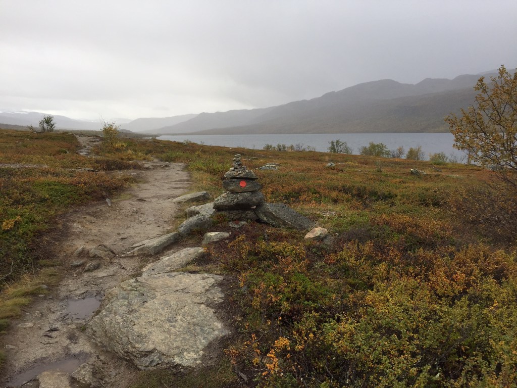
Leaving Abisko, the trail runs beside a river for most of the day – And you’re in a forest most of the day as well.

Eventually you do reach a clearing:
Something of note, there were a bunch of houses along the way off in the distance. I was told later they belonged to the local Sami people. For those unfamiliar, the Sami are nomadic people living in the lapland. It was explained to me they are similar to Native Americans. They heard reindeer, and at certain times of the year they will inhabit these houses. They were not in the area when I was there.
It was a very wet day. Overall it was not a difficult hike, though. Mostly flat. I made it to the hut fairly early, and walked about. There was another American guy there and I chatted with him a bit. I also had my first Swedish sauna and it was really nice. And, yes, you are sitting in a small steamy room naked with a bunch of other guys. But there are no showers up there so you’ve got to clean up somehow. Also, and this was just downright polite – There were two guys in the sauna chattering away in another language and one just finally looked at me and asked in English, You have no idea what we’re saying do you? I said I did not, and then they switched to English. I guess it’s nice being able to converse with the guys with whom you are sitting around naked.
The second day was a big day. First, it was the longest day at 21 km (13 miles). But it also had a big climb early in the day that brought me above the tree line. I would stay above the tree line until the very end of the trip. Once above the tree line I spent the rest of the day hiking along a long valley. I did get to see my first ever glaciers, though:

The day was still mostly overcast, but it did clear out slightly towards the end.
The huts at Alesjaure are nice. There is a main hut, with a store and a meeting area, with a wrap-around porch and fireplace, and phenomenal views. And then there are a bunch of other huts, each with kitchens and bunkrooms. I actually got a room to myself here. The sauna hut is down a hill, and the cold plunge is into a river below that. I did not do the cold plunge, but I will say people there are much less uptight about being naked than we are in the US – Being circumcised, though, I got stared at a lot…..
Alesjaure hut sits on a ridge between two valleys:

Day three was just 13 km (8.1 miles) to Tjaktja:

Most hikers bypass this shelter and head over Tjaktja Pass – The highest point on this section of the trail. I was considering doing that but the climb to this shelter really kicked my butt. So I stayed the night, and that was a fantastic decision!
Anyone who has done a long’ish hike knows that a bubble forms at some point – A group of people hiking at the same pace who you will see each night. This was the night my bubble solidified:
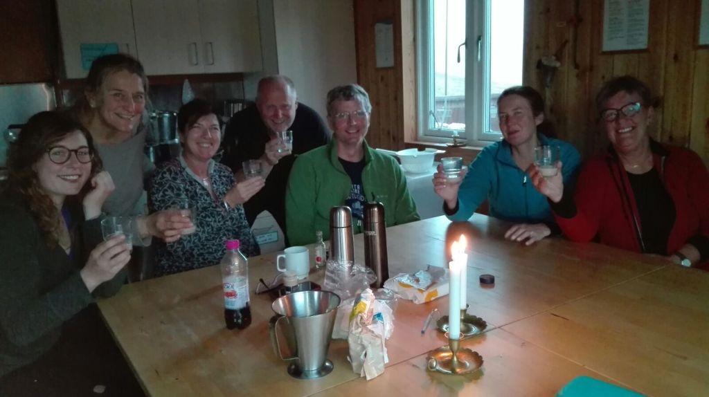
We had a rip-roaring blast, and this is probably one of my favorite nights on vacation ever.
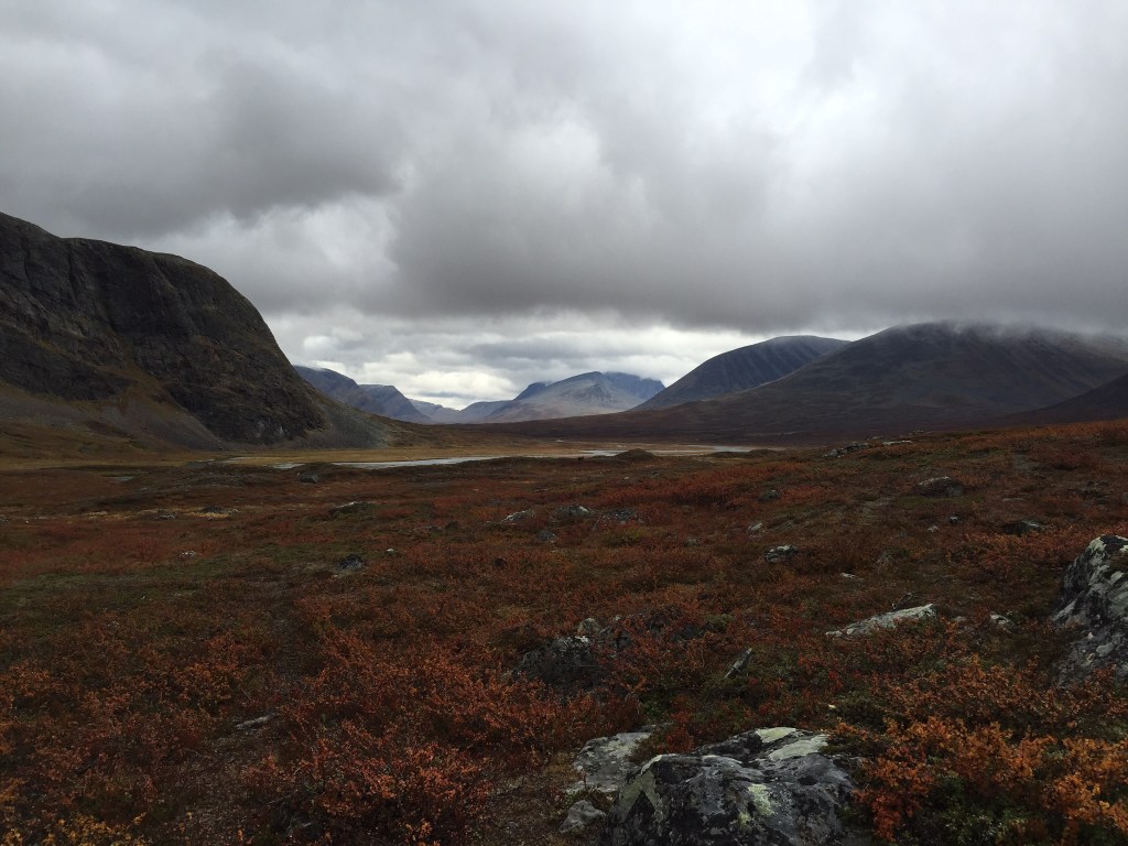
Day 4 was 12 km (7.5 miles) from Tjaktja to Salka, which wouldn’t have been too bad except for the climb over the Tjaktja Pass. It was a tough climb, and there was a dense fog, but once on the other side the valley below was clearer and beautiful.

Normally I hike by myself. It’s really peaceful to go at your own pace with no one else around. But my bubble did catch up with me this day. Apparently they had an afternoon custom of taking some medicine (Jager):


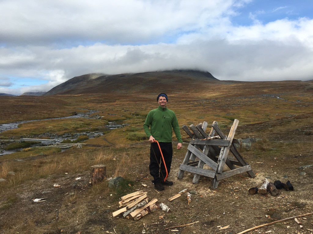
Salka is another one of the nicer huts. There was a small store with limited provisions, and I had planned in advance to do a resupply there. The sauna was also a nice one, from what I recall. Here’s me doing my duty chopping wood:
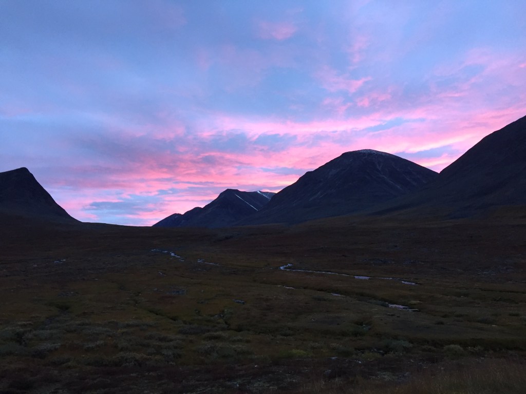
I tend to wake up early, even on vacation. Quietly I will make coffee and just read something until everyone else gets up. This morning, I was joined by a couple of the others and together we caught the most beautiful sunrise:

Day 5 was 12 km (7.5 miles) from Salka to Singi.

The hut at Singi was small, and I don’t recall this hut having a sauna. What I do recall is that it was crowded, and the weather was bad. It was crowded because this is near a place where locals will get on the trail for a weekend or overnight, and they will stay at the hut. Plus there was a very domineering host. So I stayed in my tent. The weather was awful! I was up and out early the next morning.
Day six was officially not on the Kungsleden. This was my exit point, and I headed to Kebnekaise. This is a very popular destination for locals with it being a long day-hike from the highest peak in Sweden. People from as far south as Stockholm come up to stay here. And as such, it was pretty nice! The hike to it was really tough though due to very high winds the entire day:

At Kebnekaise we made dinner reservations as group, and here is the pic:

The Kebnekaise Turistation is not cheap, but it is nice. I had a really small private room, for $150. But I also like to end a time on trail with a nice stay somewhere.

Technically I was supposed to hike one more day, from Kebekaise to Nikkaluokta, but there was a shuffle in plans with two other people so that I ended up with a ticket on the speed boat shuttle to Nikkaluokta. So, one days hike turned into a 45 minute boat ride.
This also meant that I had two nights in the local town of Kiruna, rather than the planned one night. I stayed at the Hotel Arctic Eden, and I really liked it. The room was very modern and nice. And the breakfast spread was amazing! Kiruna itself was a nice town, but my understanding is that it has since been moved due to a mining operation beneath it.
So that is my Kungsleden adventure. It was fantastic! It was perfect gift to myself for my 50th. And I do still keep in touch with the people I met on trail. After a couple nights in Kiruna, I boarded the overnight train back down to Stockholm, where I checked into a hotel for the night. I cannot remember the name of the hotel – It was extremely close to the main train station downtown. But the room was extremely small (the bed touched both walls), had no windows, and cost around $200. But I did have the afternoon to explore Stockholm, and I will say I absolutely must go back and spend more time there sometime.
I hope you’ve enjoyed reading about this adventure. Let me know if you have questions.
#GenX #Retirement #PreRetirementPlanning #Adventure #GenerationX #AdventureBlogger #PassportPassion #Travel #backpacking #Kungsleden #Abisko #Abiskojaure #Alesjaure #Tjaktja #Salka #Singi #Kebnekaise #Kiruna #CodyDuncan #Sweden #SwedishArctic
